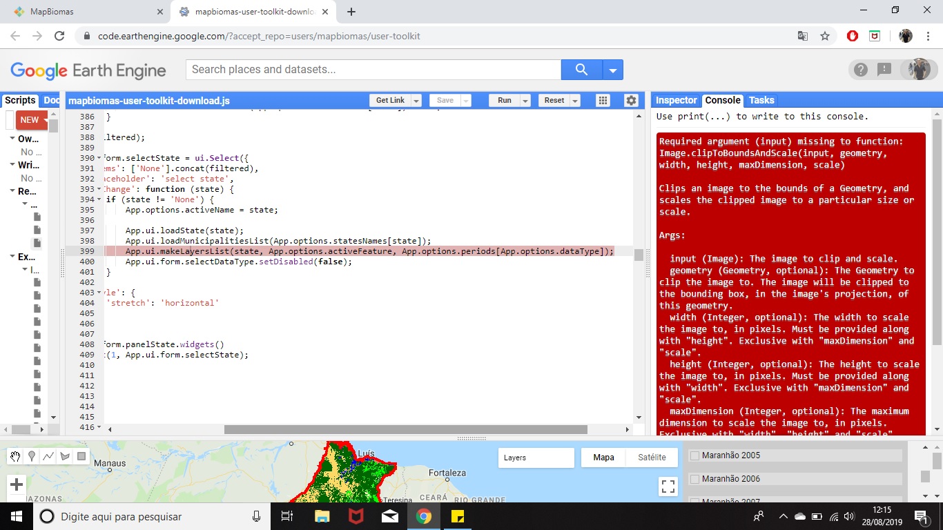
Olá, estou acessando o site do MAPBIOMAS para análise de alguns dados para minha pesquisa, mas não consigo baixar os dados via Google Earth Engine. Isso me causa estranheza, pois até mês passado consegui efetuar alguns downloads para o estado do Maranhão, quando seleciono os dados, o GEE dispara esse aviso na parte de CONSOLE:
Required argument (input) missing to function: Image.clipToBoundsAndScale(input, geometry, width, height, maxDimension, scale)
Clips an image to the bounds of a Geometry, and scales the clipped image to a particular size or scale.
Args:
input (Image): The image to clip and scale.
geometry (Geometry, optional): The Geometry to clip the image to. The image will be clipped to the bounding box, in the image’s projection, of this geometry.
width (Integer, optional): The width to scale the image to, in pixels. Must be provided along with “height”. Exclusive with “maxDimension” and “scale”.
height (Integer, optional): The height to scale the image to, in pixels. Must be provided along with “width”. Exclusive with “maxDimension” and “scale”.
maxDimension (Integer, optional): The maximum dimension to scale the image to, in pixels. Exclusive with “width”, “height” and “scale”.
scale (Float, optional): If scale is specified, then the projection is scaled by dividing the specified scale value by the nominal size of a meter in the image’s projection. Exclusive with “width”, “height” and “maxDimension”.
in export2Drive(), line 399
in onClick(), line 590
…
E na aba do Script, o GEE marca esta linha:
App.ui.makeLayersList(state, App.options.activeFeature, App.options.periods[App.options.dataType]);
O que estaria acontecendo e como resolver esse problema?